Watervliet, New York
| Watervliet | |
| Land | |
|---|---|
| Delstat | |
| County | Albany County |
| Höjdläge | 9 m ö.h. |
| Koordinater | 42°43′29″N 73°42′22″V / 42.72472°N 73.70611°V |
| Area | 3,82 km² (2010)[2] |
| Folkmängd | 10 375 (2020)[3] |
| Befolkningstäthet | 2 715 invånare/km² |
| Grundad | 1896[1] |
| Tidszon | EST (UTC-5) |
| - sommartid | EDT (UTC-4) |
| ZIP-kod | 12189 |
| Riktnummer | 518 |
| GNIS-kod | 979606 |
| Geonames | 4833276 |
Översiktskarta | |
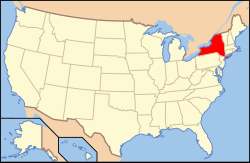
New Yorks läge i USA | |
| Wikimedia Commons: Watervliet, New York | |
| Webbplats: http://www.watervliet.com/ | |
| Redigera Wikidata | |
Watervliet är en ort i Albany County i delstaten New York, USA.
Referenser
- ^ hämtat från: engelskspråkiga Wikipedia.[källa från Wikidata]
- ^ United States Census Bureau, 2010 U.S. Gazetteer Files, United States Census Bureau, 2010, läst: 9 juli 2020.[källa från Wikidata]
- ^ United States Census Bureau (red.), USA:s folkräkning 2020, läs online, läst: 1 januari 2022.[källa från Wikidata]
Media som används på denna webbplats
Författare/Upphovsman: Huebi, Licens: CC BY 2.0
Map of USA with New York highlighted
Författare/Upphovsman: Rcsprinter123, Licens: CC BY 3.0
Map showing the location of this town within Albany County, New York.
Författare/Upphovsman: UpstateNYer, Licens: CC BY-SA 3.0
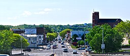
View of Watervliet, New York, United States, from the Congress Street Bridge (New York State Route 2) This photo includes St. Patrick's Church (on the right hand side) which was leveled in May 2013.


