Lamont, Florida
| Lamont | |
| CDP | |
| Land | |
|---|---|
| Delstat | |
| Höjdläge | 19 m ö.h. |
| Koordinater | 30°22′37″N 83°48′47″V / 30.37694°N 83.81306°V |
| Area | 6,08 km² (2010)[1] |
| Folkmängd | 170 (2020)[2] |
| Befolkningstäthet | 28 invånare/km² |
| Tidszon | |
| GNIS-kod | 2628525 |
| Geonames | 4161523 |
Ortens läge i delstaten | |
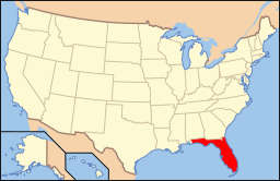
Floridas läge i USA | |
| Redigera Wikidata | |
Lamont är en ort i Jefferson County i delstaten Florida, USA.
Referenser
- ^ United States Census Bureau, 2010 U.S. Gazetteer Files, United States Census Bureau, 2010, läst: 9 juli 2020.[källa från Wikidata]
- ^ United States Census Bureau (red.), USA:s folkräkning 2020, läs online, läst: 1 januari 2022.[källa från Wikidata]
Media som används på denna webbplats
Shiny red button/marker widget. Used to mark the location of something such as a tourist attraction.
Författare/Upphovsman: This version: en:User:Huebi
Base versions this one is derived from: originally created by en:User:Wapcaplet, Licens: CC BY 2.0
Map of USA with Florida highlighted


