Bubiyan
| Bubiyan (بُوبِيَان) | |
| Ö | |
Satellitbild av Būbiyān (nederst till höger). | |
| Land | |
|---|---|
| Provins | al-Jahra |
| Koordinater | 29°46′11″N 48°15′20″Ö / 29.76972°N 48.25556°Ö |
| Area | 863,00 km² |
| Tidszon | FET (UTC+3) |
| Geonames | 285659 |
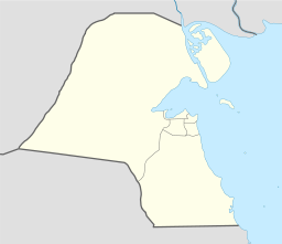
Läge i Kuwait | |
Bubiyan (arabiska: بُوبِيَان), eller Jazirat Bubiyan (جَزِيرَة بُوبِيَان), är en ö i Kuwait.[1] Den ligger i provinsen al-Jahra, i den nordöstra delen av landet, 50 km nordost om huvudstaden Kuwait. Arean är 863 kvadratkilometer.
Källor
- ^ Jazīrat Būbiyān hos Geonames.org (cc-by); post uppdaterad 2012-02-02; databasdump nerladdad 2015-05-23
Media som används på denna webbplats
Shiny red button/marker widget. Used to mark the location of something such as a tourist attraction.
Författare/Upphovsman:
This Envisat image features the Kuwait islands of Warbah and Bubiyan, located at the head of the Persian Gulf.
What appears to be water across the top and right side of the image (lilac, green and blue) is land. The brighter yellow, aqua and pink colours represent water. Here, the water currents in these channels can be observed thanks to the radar imagery as they flow out into the gulf.
The image was created by combining three Advanced Synthetic Aperture Radar (ASAR) acquisitions (22 August 2009, 26 September 2009 and 31 October 2009) taken over the same area. The colours in the image result from variations in the surface that occurred between acquisitions.Författare/Upphovsman: NordNordWest, Licens: CC BY-SA 3.0
Location map of Kuwait


