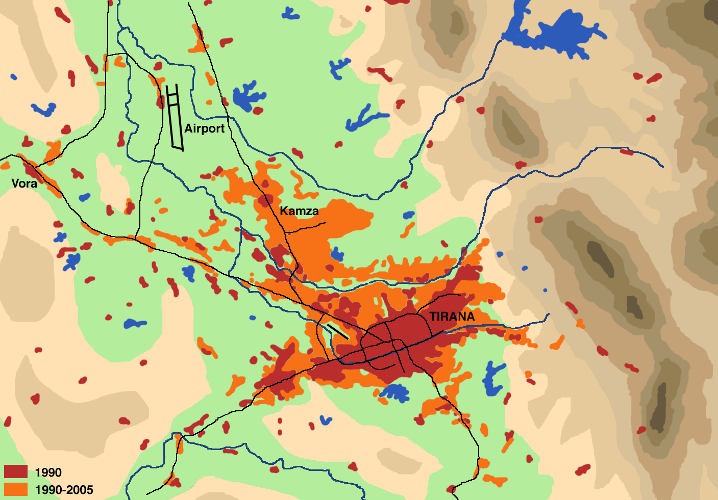
Tirana Expansion
Författare/Upphovsman:
Tillskrivning:
Bilden är taggad "Attribution Required" men ingen tillskrivningsinformation lämnades. Attributionsparametern utelämnades troligen när MediaWiki-mallen användes för CC-BY-licenserna. Författare och upphovsmän hittar ett exempel för korrekt användning av mallarna här.
Kreditera:
Drawn by myself on the basis of
- map by Institue for Habitat Development in Besnik Aliaj, Keida Lulo und Genc Myftiu: Tirana - The Challenge of Urban Development (Tirana 2003, ISBN 99927-880-0-3)
- Google Map satellite pictures
- Official Albanian Maps 1:50000 of the late 1980ies
Literature:
- Besnik Aliaj, Keida Lulo und Genc Myftiu: Tirana - The Challenge of Urban Development. Tirana 2003, ISBN 99927-880-0-3
- Dietmar Richter: Flächennutzungswandel in Tirana. Untersuchungen anhand von Landsat TM, Terra ASTER und GIS. (= Praxis Kultur- und Sozialgeographie; 42). Universitäts-Verlag, Potsdam 2007, ISBN 978-3-939469-64-3 (complete text)
Kort länk:
Källa:
Upplösning:
1407 x 981 Pixel (358821 Bytes)
Beskrivning:
Schematical illustration of the population development (settlement area, commercial zones) in the region of Tirana from 1990 to 2005
Licens:
Licenskommentaren:
Jag, upphovsrättsinnehavaren av detta verk, publicerar härmed det under följande licens:
Licensvillkor:
Creative Commons Attribution-Share Alike 2.5
Mer information om licensen för bilden finns här. Senaste uppdateringen: Mon, 06 Jan 2025 16:58:08 GMT