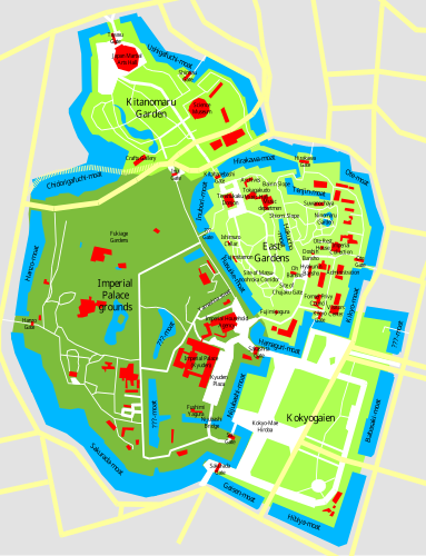
Imperial Palace Tokyo Map
Författare/Upphovsman:
- Imperial_Palace_Tokyo_Map.png: User:Chris 73
- derivative work: ExplicitImplicity (talk)
Tillskrivning:
Bilden är taggad "Attribution Required" men ingen tillskrivningsinformation lämnades. Attributionsparametern utelämnades troligen när MediaWiki-mallen användes för CC-BY-licenserna. Författare och upphovsmän hittar ett exempel för korrekt användning av mallarna här.
Kreditera:
Kort länk:
Källa:
Upplösning:
383 x 500 Pixel (393641 Bytes)
Beskrivning:
This is the SVG version of Image:Imperial Palace Tokyo Map.sxd, checked with a GoogleMaps Satellite Image and corrected for proportions.
Notes by the original authoru:
This is a map of the Imperial Palace in Tokyo (Kokyo), drawn by me based on various sources and satelite pics. Disclaimer: Many locations are only approximate, not all streets, buildings, and waterways are shown, I give no guarantee for accuracy, use at your own risk.
Licens:
Licensvillkor:
Creative Commons Attribution-Share Alike 3.0
Mer information om licensen för bilden finns här. Senaste uppdateringen: Wed, 29 Jan 2025 21:42:35 GMT
