Alamannien Hochburgund ca 1000
Författare/Upphovsman:
Kreditera:
own work; G. Droysen: Allgemeiner Historischer Handatlas. Bielefeld / Leipzig, 1886, 22f.
Kort länk:
Källa:
Upplösning:
2500 x 2107 Pixel (1166320 Bytes)
Beskrivning:
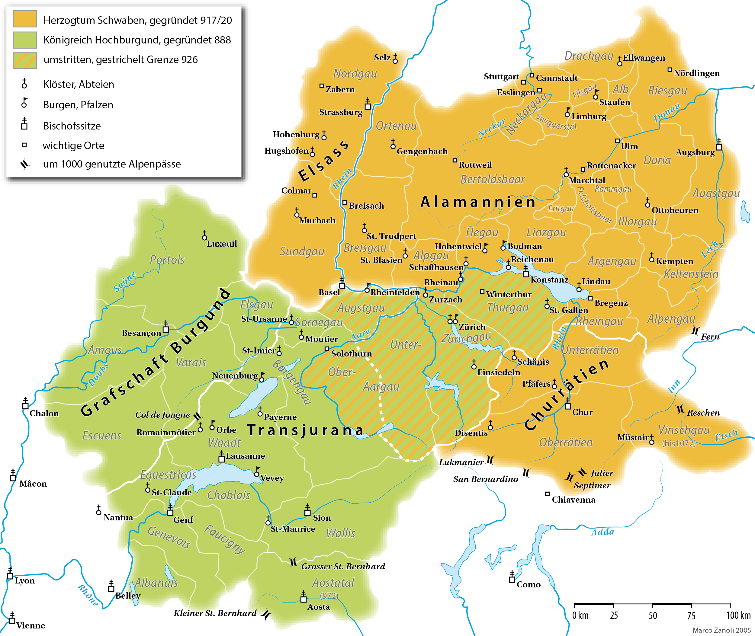
A map (in German) of the Duchy of Alamannia and the Kingdom of Upper Burgundy in the 10th century.
Licens:
Licensvillkor:
Creative Commons Attribution-Share Alike 4.0
Mer information om licensen för bilden finns här. Senaste uppdateringen: Wed, 19 Feb 2025 02:12:48 GMT